How to open elevation data in QGIS
Order elevation data for your area of interest, e.g. in GeoPackage (QGIS) and GeoTIFF format choosing the step of contour lines.
Go to the orders page and download the archive when it’s complete.
Unpack the archive.
Download and install QGIS.
Launch QGIS.
To open a preset GIS project (which includes all layers with customized styles), click “Project” > “Open” and in pop-up window select the saved file “data.qgs”.
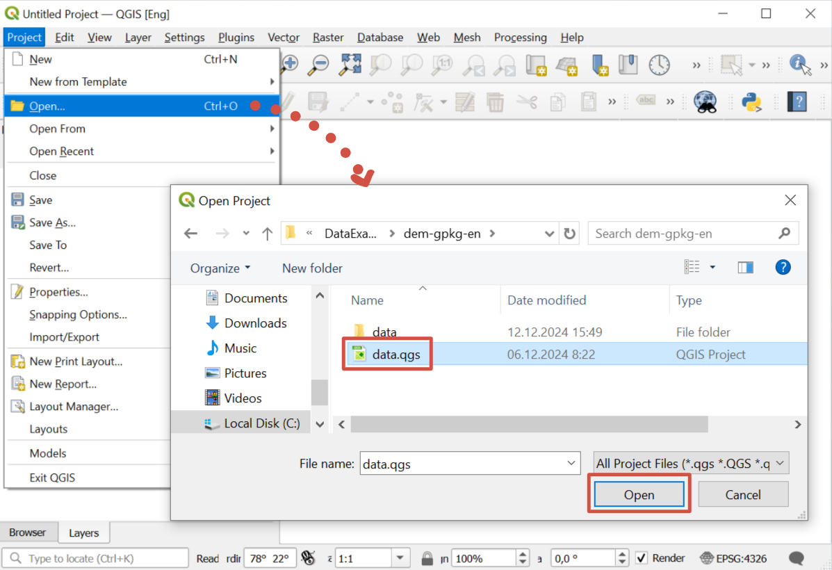
The project will be added to QGIS; data is ready to go.
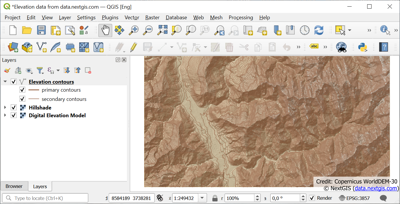
You can also add elevation data as files to an existing project.
Drag and drop the following files from the unpacked data folder to QGIS interface: hillshade.tif, dem.tif and contour_lines (extention depends on the file type, for example if you purchased Shape file, you’ll need contour_lines.shp).
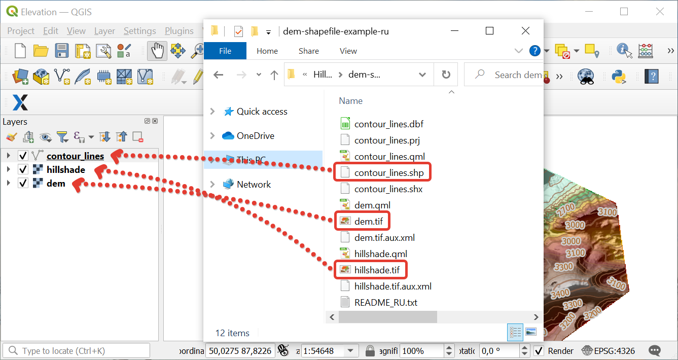
Arrange the layers in the list in the most convenient way to work from top to bottom:
Contours
Hillshade
DEM
Detailed video How to open elevation data in QGIS - can be viewed here