How to change the language of labels in OSM data
Order data for your area of interest in Geopackage (QGIS) format.
Go to the orders page and download the archive when it’s complete.
Unpack the archive.
Download and install QGIS.
Launch QGIS and open the project file data.qgs.
Select the layer where you want to change the label language or enable labels if they are not displayed.
Double click the layer or use context menu to open Layer Properties. Open the Labels section. In the “Value” field select from a dropdown menu the correct attribute for the labels.
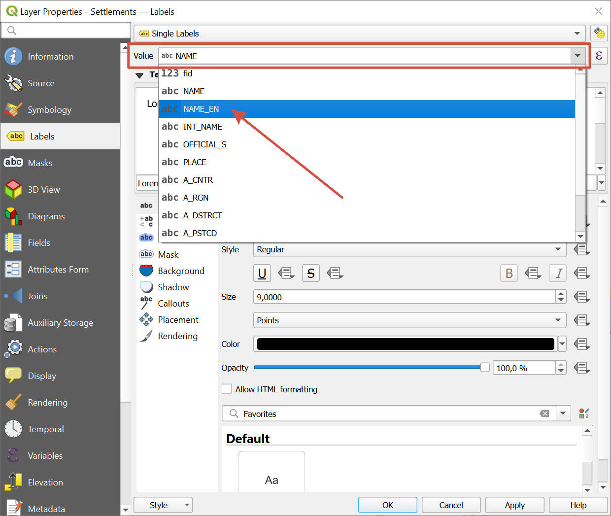
In the OSM data structure the attributes are:
NAME - name in the local language, i.e. the most common language of the area. For example, Greek for Greece.
NAME_EN - name in English
If the local name is in English itself, the other attribute may be empty.