How to get municipal boundaries for a target region
Order data for your area of interest, for example in GeoPackage format.
Go to the orders page and download the archive when it’s complete.
Unpack the archive.
Launch QGIS and in the main menu select “Layer” > “Add Layer” > “Add Vector Layer…”. In a pop-up window from downloaded folder “data” select file “boundary-polygon-land-lvl6”.
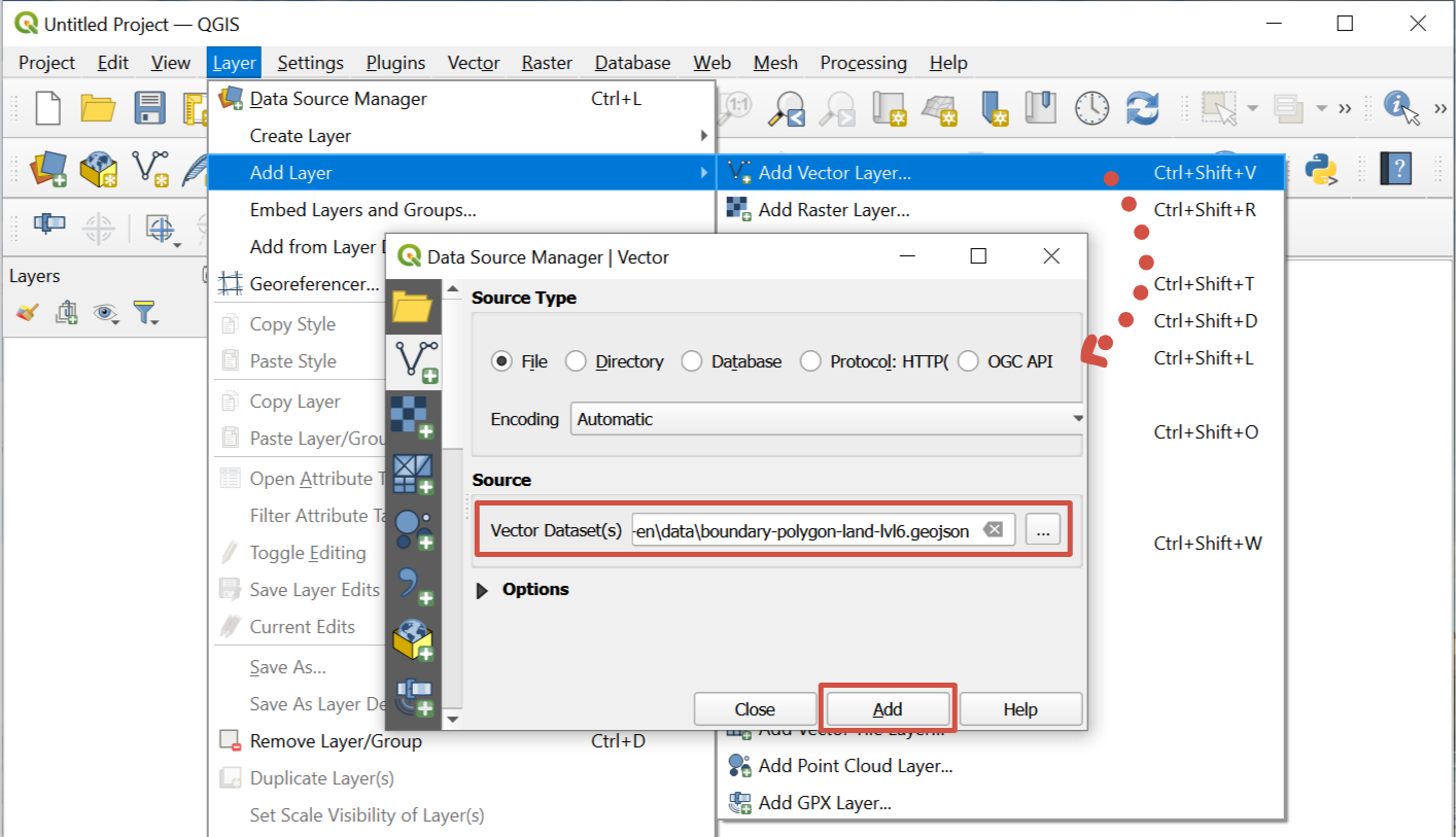
Pic. 10 Adding layer from GeoJSON file
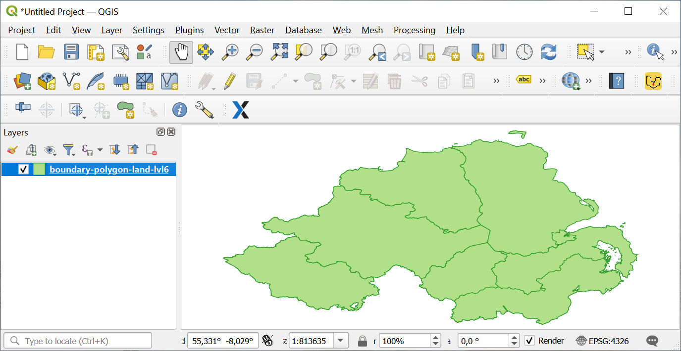
Municipalities’ boundaries are imported in GIS.
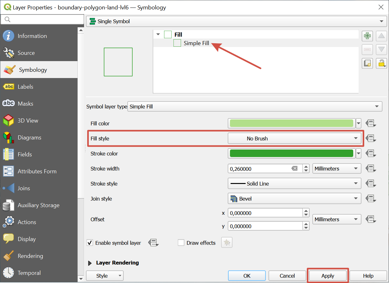
If you want municipalities to be shown as outlines, right-click on a layer and select “Properties”. In pop-up window select Symbology > Simple fill > Fill style=“No Brush” and press Apply.
Note
Types and levels of administrative boundaries differ from country to country. Thus file “boundary-polygon-land-lvl6” can refer to various levels of administrative division, depending on particular country. To find out about your area of interest please check here.