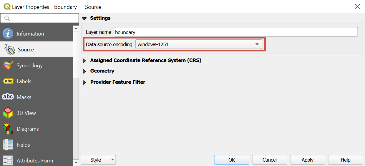
How to change data encoding
Order data for your area of interest, e.g. in GeoJSON format.
Go to the orders page and download the archive when it’s complete.
Unpack the archive.
Import target layer, which encoding you want to change, in QGIS.
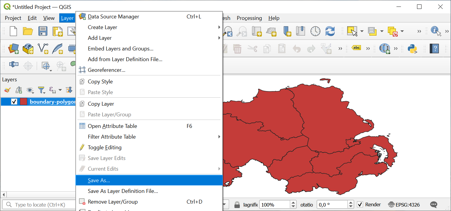
Right-click on a target layer in Layers Panel, select option “Save as…”. Thus you’ll create a copy of the layer, but in desired encoding.
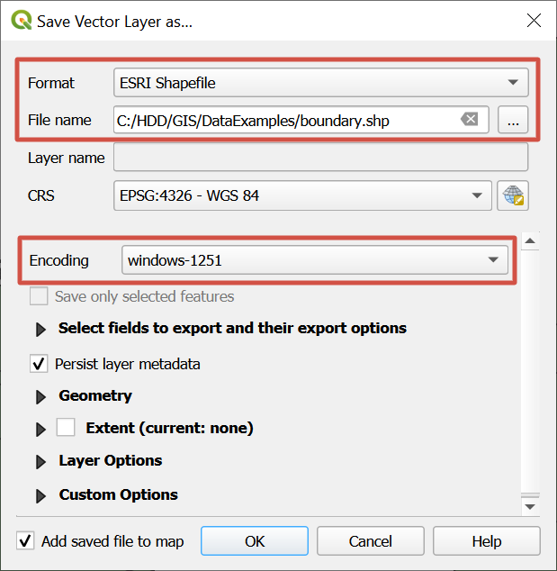
In the pop-up window select format “ESRI Shapefile” and the desired encoding (in this example - windows-1251), and also specify a name and a path to a new file. Press “OK”.
A new layer with the desired encoding will be created.