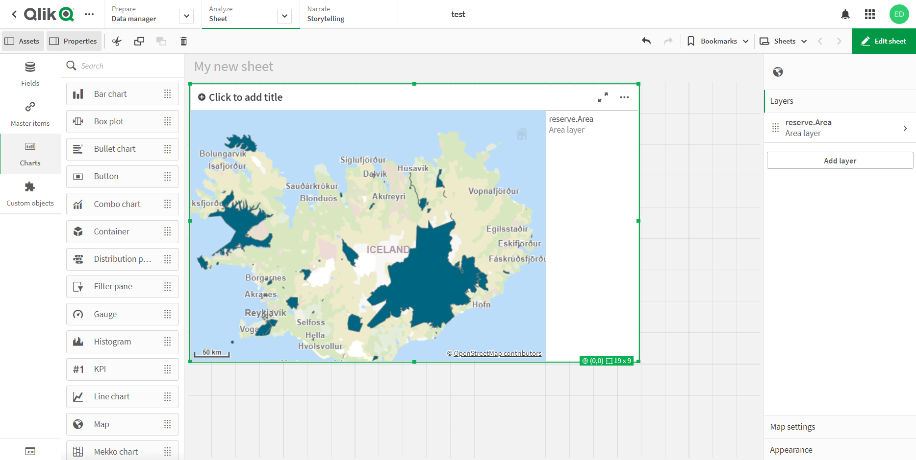
How to load data into Qlik Sense
Order data for your area of interest, e.g. in GeoJSON (QGIS) format.
Go to the orders page and download the archive when it’s complete.
Unpack the archive.
Convert the desired layer or layers to KML format. For conversion, you can use any online converter, for example, Mapshaper or QGIS export to KML format.
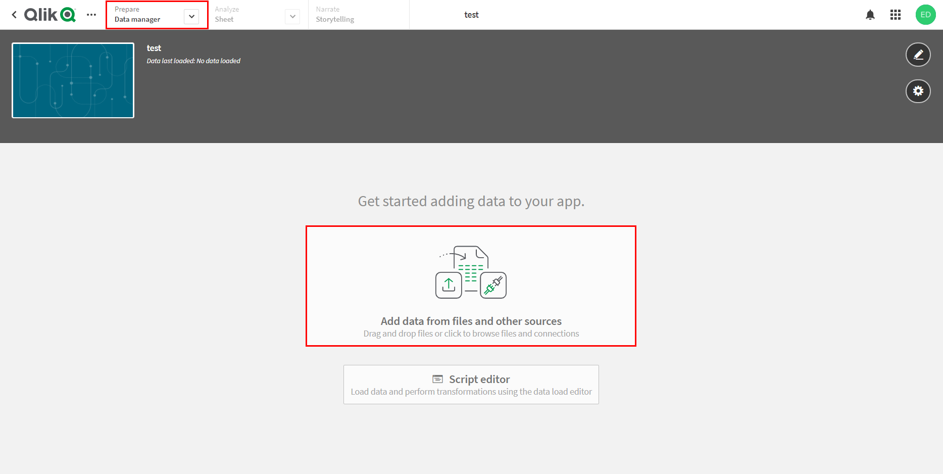
In created Qlik Sense app go to “Data manager” tab and select “Add data from files and other sources”.
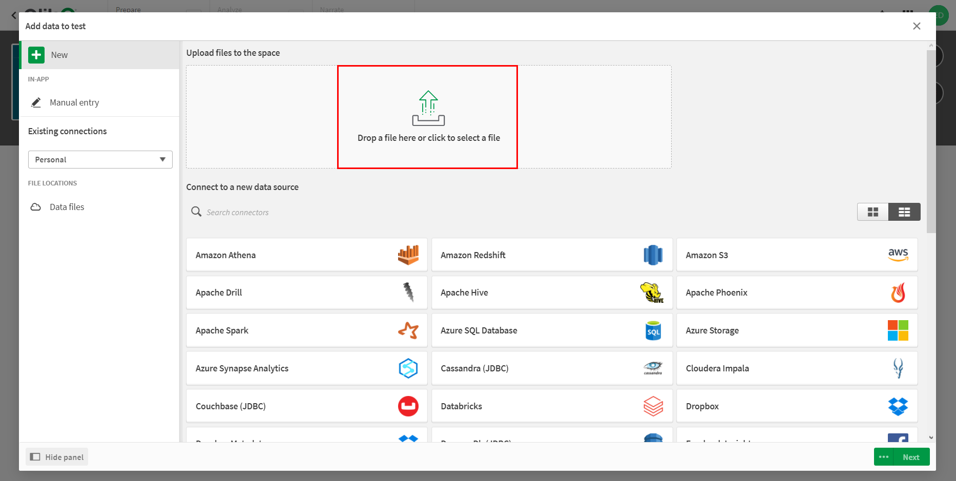
In pop-up window add previously obtained KML file.
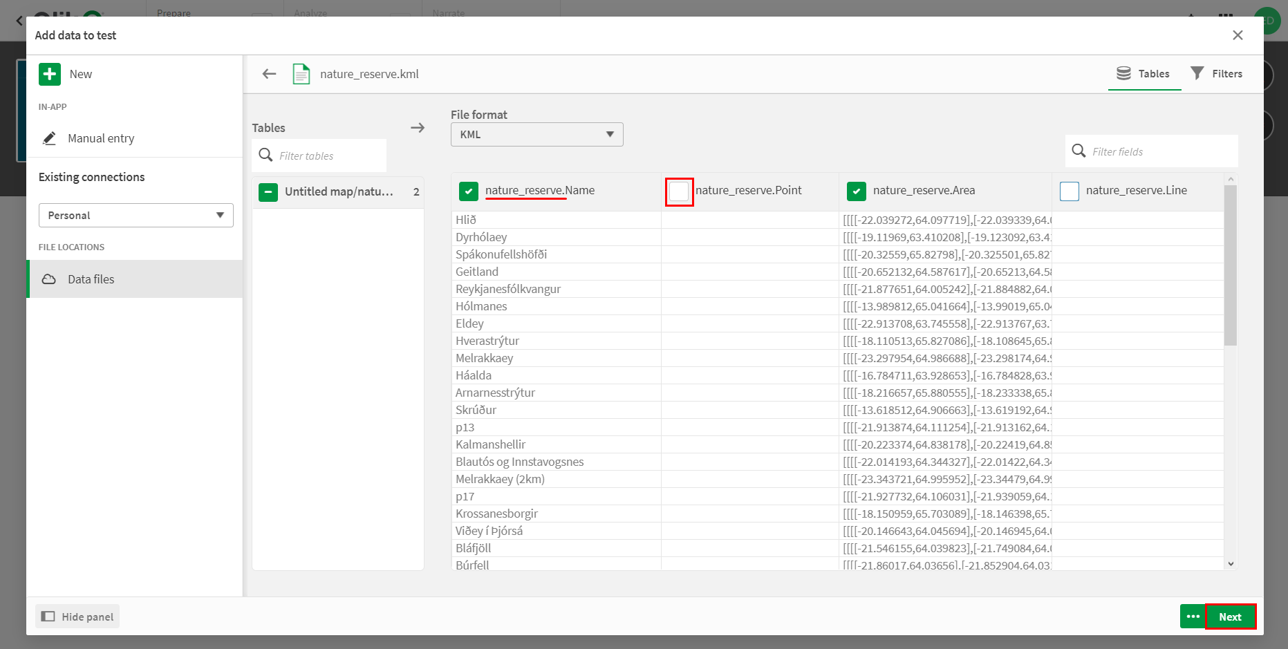
On the next step it is recommended to uncheck the boxes opposite to empty fields and also to rename the fields which have long names. Then click “Next”.
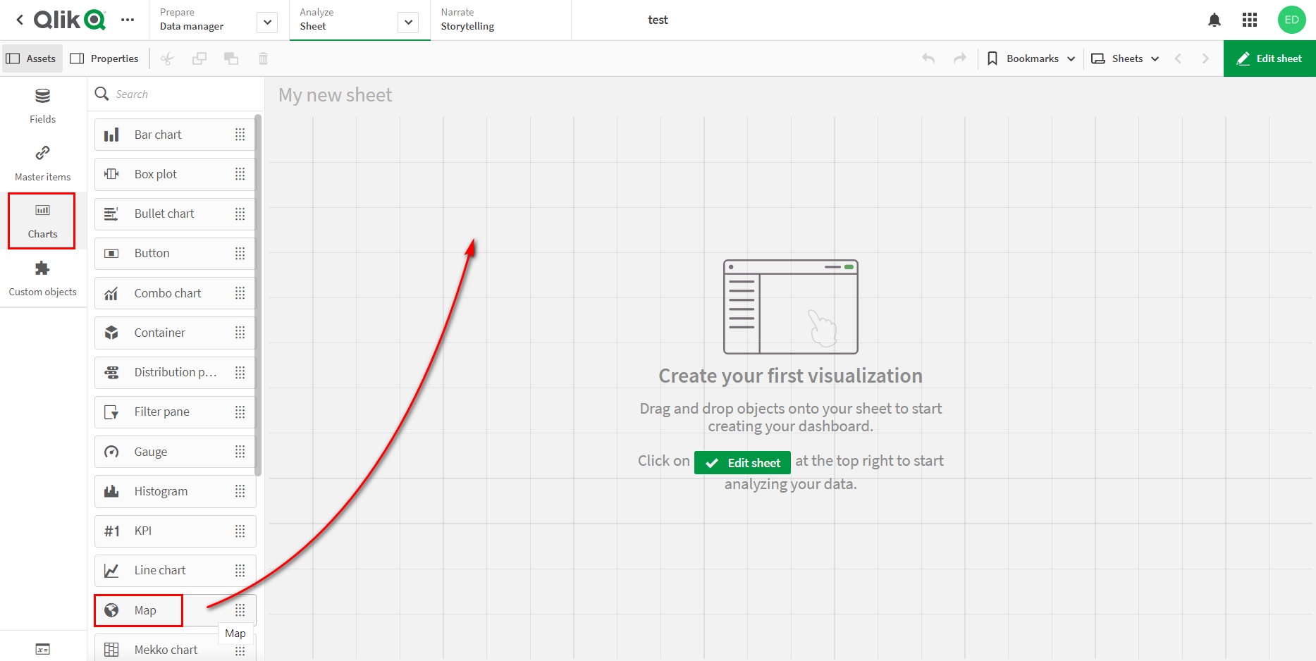
After uploading the data you will be redirected to the sheet. Choose “Charts” > “Map” and drag the icon to add a map to the sheet.
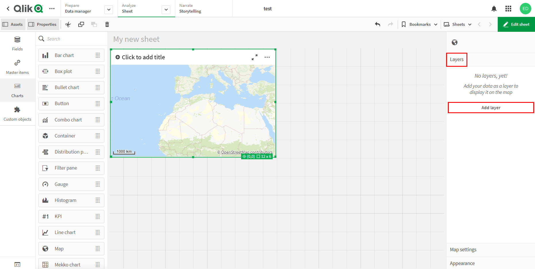
Select “Layers” > “Add layer” from the menu located on the right side of the map.
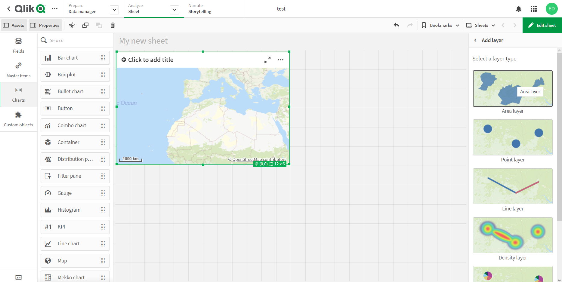
Select the layer type. In this example we are adding polygonal objects, so we select “Area layer”. If you want to add a layer with point or line objects, select “Point layer” or “Line layer”, respectively.
In the “Data” > “Dimensions” tab, from the drop-down list, select the field of the loaded layer, which contains information about the coordinates of the objects.
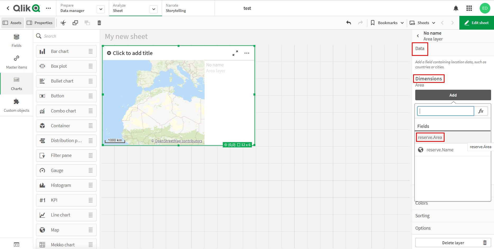
Layer is added to the map.