How to get coordinates of a target object
Order data for your area of interest, e.g. in GeoPackage (QGIS) format.
Go to the orders page and download the archive when it’s complete.
Unpack the archive.
Add a layer with target object to QGIS.
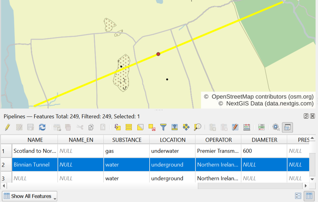
Find target object on the map (or through attribute table) and select it. Selected point object is highlighted with yellow on the map and with blue – in attribute table. If you selected an object through the map, use “Move selection to top” button to locate it in attribute table.
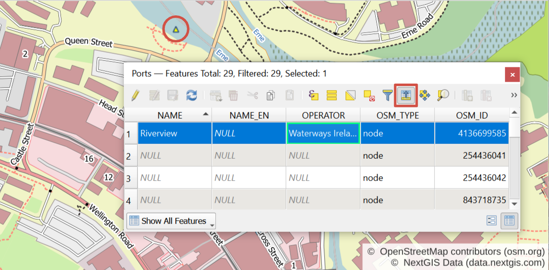
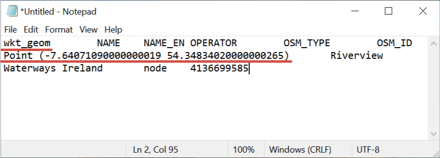
Do not deselect feature in attribute table and press “Ctrl + C” (it allows to copy all attributes of a target object) and then paste it into any text or table editor or processor. In a very first column named “wkt_geom” you will find coordinates of one or several points (if your target object is a line or polygon), belonging to the object.
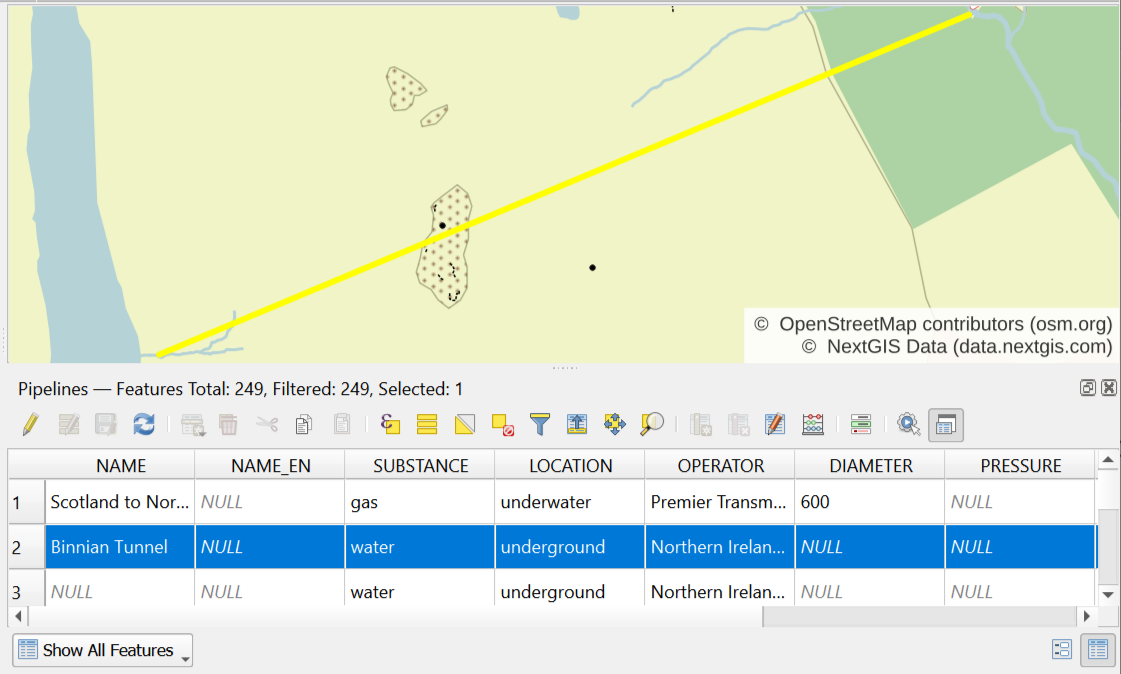
If desired it is possible to get coordinates of the middle of a line object. Select target object through the map or attribute table.
Then in a Processing Toolbox Panel (press “Ctrl+Alt+T” to display) find and select GDAL/OGR algorithm “Create points along lines”. In pop-up window choose a layer with a target object as an “Input layer”. For shapefiles set “geometry” into “Geometry column name” field. Set “0.5” into “Distance from line start…” field. Press “Run”. If you only need the middle of one particular feature of the layer, tick “Selected feature”.
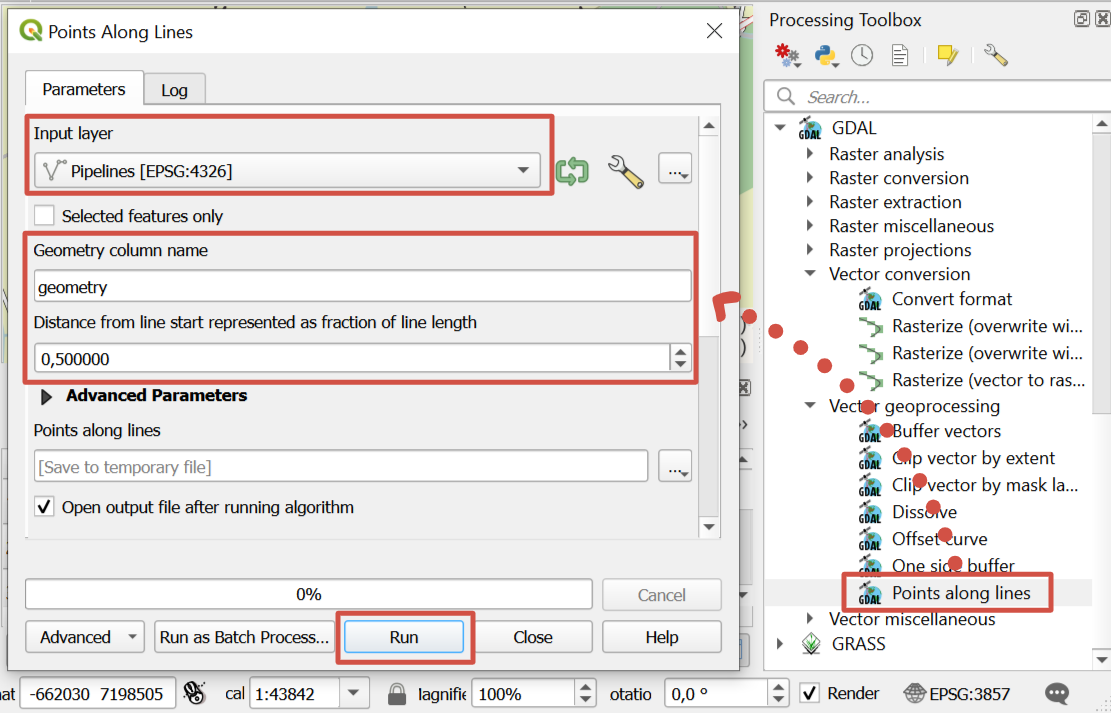
As a result new layer is created with a point located exactly in a middle of target line. To get point’s coordinates please see instruction above.
If desired it is possible to get coordinates of the center of a polygon object. Install plugin “realcentroid”. Then select target object through the map or attribute table. Launch “realcentroid” plugin. In pop-up window set layer with a target object, check boxes “Selected features only” and “Add to map canvas”, set name and path for output layer.
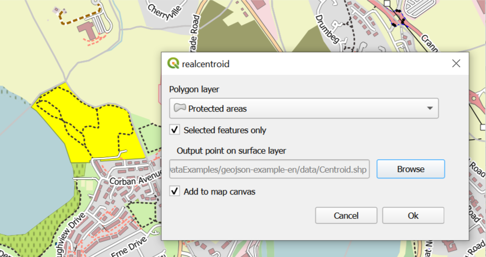
As a result new layer is created with a point located in the centre of target polygon. To get point’s coordinates please see instruction above.